Strengthening Resilience and Crisis Response Through Geospatial Innovation
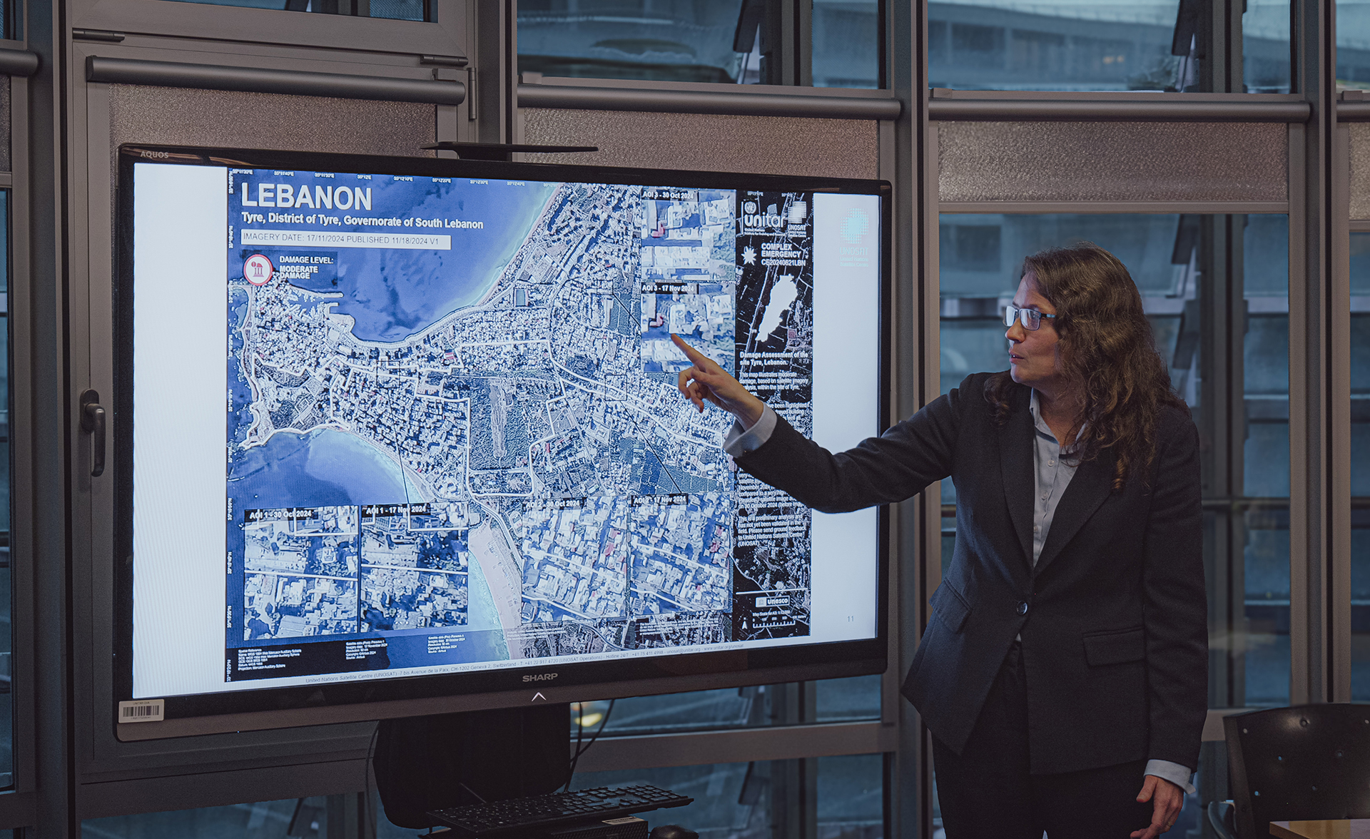
The Emergency Mapping Service (EMS) of the United Nations Satellite Centre (UNOSAT) was activated 65 times in response to sudden-onset disasters across 43 countries, 75 per cent of which were climate-related, delivering 454 timely analytical outputs. As a trusted partner of the International Space Charter 10 and GDACS, UNOSAT prioritized support to countries in special situations. In South Sudan alone, 15 satellite analyses guided flood preparedness and response by national and humanitarian teams.
Read more in the full report >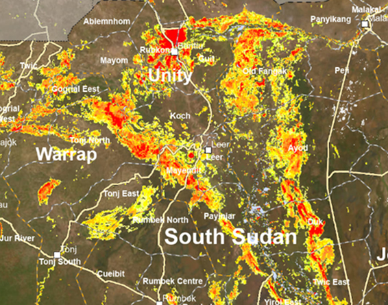
Without UNOSAT, it would be difficult to obtain accurate and up-todate information on the level of destruction. Given the level of insecurity and attacks against humanitarian o rganizations, UNOSAT’s satellite analysis proved to be indispensable.

Majed Abuqubu
Head of Information Management at OCHA OPT
UN OCHA: From Space to Humanitarian Response
Driving Innovation in Learning and Governance
In 2024, UNITAR accelerated digital transformation in learning by equipping trainers and institutions with AI-powered tools and inclusive design strategies. UNITAR Digital Training of Trainers Solutions were recognized among the Top 20 finalists of the SDG Digital Gamechanger Awards, while the UNITAR Masterclass Series introduced AI-driven facilitation tools and a prompt library to strengthen training quality and impact.
Read more in the full report >

Things become better when they are informed. If we embed systems thinking, it enables a more agile response and adaptive governance.
Elizabeth Agathine
Victoria, Seychelles
Systems Thinking and Strategic Foresight for National Planning